OneAquaHealth City Dashboards
Access real‑time environmental insights!
The OneAquaHealth City Dashboards are interactive web tools that make environmental and research data easy to access for citizens, researchers, and public institutions. By using intuitive visual interfaces, users can explore city‑specific indicators such as water quality, biodiversity, and pollution.
Sign up for the Citizen Science App!
and help protect urban streams across Europe and beyond!
The Citizen Science App invites everyone to take an active role in understanding and protecting local stream ecosystems. By combining simple data collection tools with engaging features and clear visual feedback, the App empowers citizens to observe, report, and learn about the health of their urban waterways.
Dive into the OneAquaHealth Resilience Map
and unlock data‑driven insights for healthier waterways!
The OneAquaHealth (OAH) Resilience Map is an interactive tool that brings together biodiversity, environmental data, pathogens, weather, and satellite indicators to assess the health of urban water ecosystems across five European countries. Users can explore indicators, track changes, compare sites, and view data through dynamic maps, graphs, and tables. The tool supports evidence‑based decisions by offering clear insights and exportable data.
Explore GEOSSIP -
your gateway to structured, shared, and actionable One Health data!
The GEOSSIP platform streamlines data management and accessibility, empowering authorized users to organize, analyze, and apply insights across disciplines.
Turn indicators into action -
use the OneAquaHealth Decision Support System for urban stream rehabilitation!
The Decision Support System (DSS) helps identify suitable rehabilitation measures for urban and peri‑urban streams. Users first select indicators describing the stream’s condition. The DSS then identifies likely impairments and their underlying stressors. Finally, it recommends matching rehabilitation measures. The tool supports expert judgement but does not replace it; local conditions must guide final decisions.
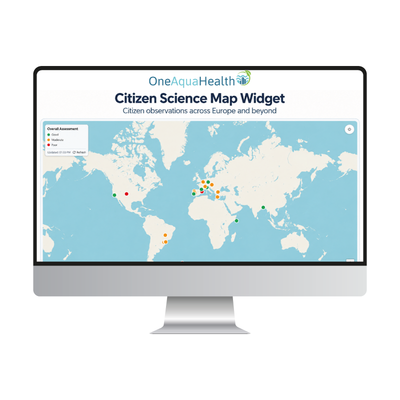
OneAquaHealth Citizen Science Map Widget
Explore citizen observations from across Europe and beyond through the interactive OneAquaHealth Citizen Science Map Widget!
The widget visualizes all observations submitted through the Citizen Science App, regardless of their location and extending beyond the project's pilot sites. Each point on the map provides selected information about the corresponding observation, offering an accessible overview of citizen participation in monitoring local stream ecosystems.
Explore DipteraCAST
Predict Diptera occurrence from environmental data
DipteraCAST is a predictive tool that estimates the occurrence probability of Diptera
taxa based on user-provided environmental data. Users can select OneAquaHealth
monitoring sites or add custom locations, upload data through a structured CSV
template, and obtain site-specific predictions for individual taxa. The tool supports
ecological assessment and One Health surveillance by helping explore how
environmental conditions may influence Diptera presence.